10 years, 2 months ago
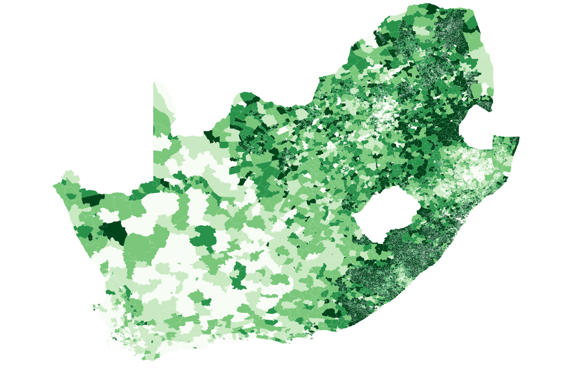
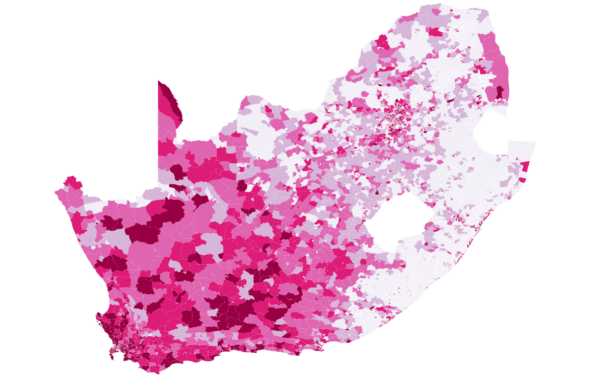
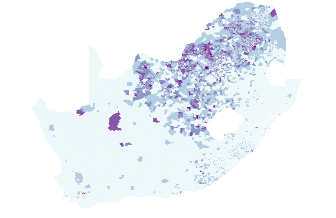
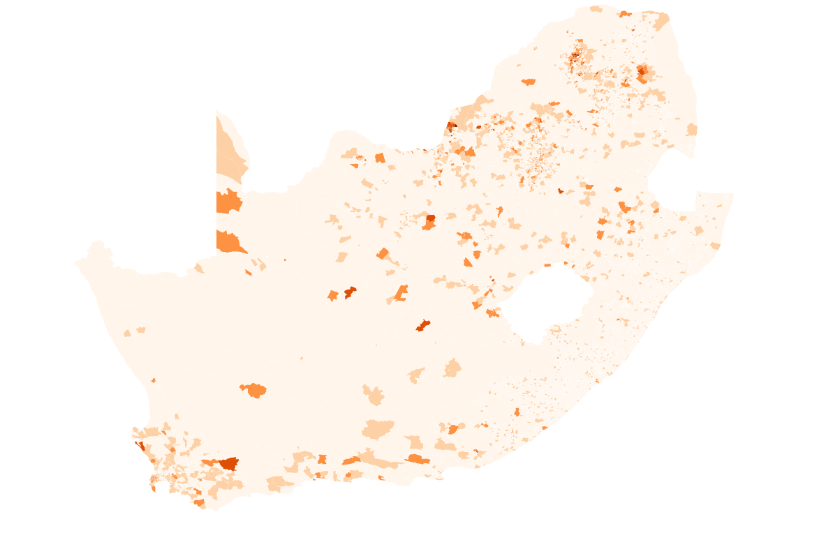
More fun with IEC elections results data (and maps). The images below show party results (% of votes) by district for a couple of parties. Made using QGIS - I might get a better map up with TileMill soon.
Results data this zipfile, spatial data this shapefile. The IEC should eventually release and official results dataset; this is not it.
Click the image for the larger version.
ANC
DA
EFF
AGANG SA
IFP
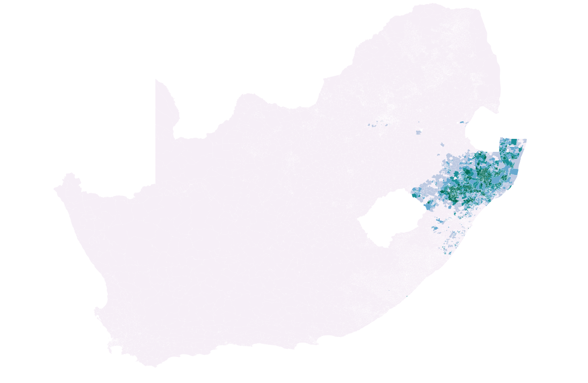
NFP
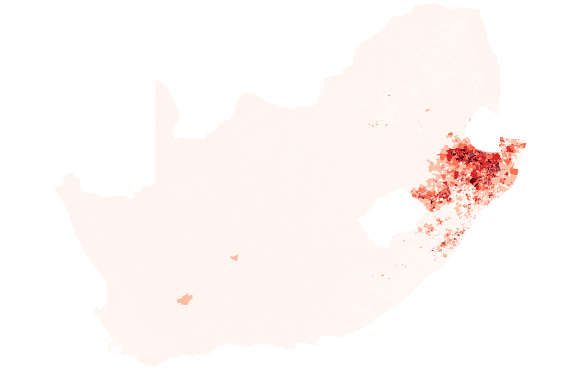
I'm not pretening to be able to make a coherent argument with these, but in general, there seems like nothing too surprising here. The DA is strong in the Western Cape and Gauteng, the ANC in the Eastern half of the country. The IFP and NFP fight it out overy very little territory. AGANG SA did poorly almost everywhere, with a bit of support in the Western Cape and Gauteng and along the Garden Route. The EFF did seem to do relatively better in the mining areas of Rustenberg and Thabazimbi, i.e. the area around the Marikana mine.
Recent Posts
- Heartbeat Choker
- 2014 elections party results maps
- Voter Turnout in the 2014 South African Elections
- Open Access to ICTD Research
- Let them eat cellphones?
Archive
2015
- October (1)
2014
- May (2)
2013
Categories
- arduino (2)
- beforeiforget (4)
- digital methods (1)
- dissertation (1)
- django (2)
- gis (4)
- internet activism (1)
- mobiles and development (1)
- networkanalysis (1)
- R (2)
- research (1)
- sewing (1)
- ubuntu (2)
Comments
New Comment